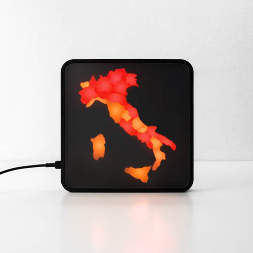
In Italy, during this pandemic period, Decrees of the President of the Council of Ministers (DPCM) are very frequent and the restrictions vary from region to region. Each region will have a color assigned under these restrictions and the variations of each decree will make the various colors impossible to remember.
Colors of Italy is a bright digital map, always updated, which shows in real time in which colored band each Italian region is located.
Thanks to a robust system of continuous updates, based on the application of machine learning on official sources, Colors of Italy is able to retrieve constantly updated information from the DPCMs launched. All you need is a plug and a WiFi connection.
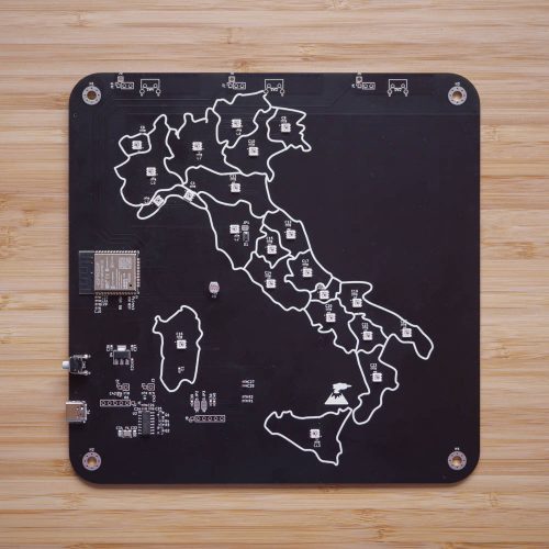
The project in question is Open-Source so it is possible to consult the code, the schematic and the files for 3D printing directly on the Github page. In particular, there is an ESP32 to manage the colors and the internet connection, several WS2812 RGB LEDs and a CH340 integrated circuit to manage the serial communication between microcontroller and PC.