FairWind, already awarded 1st in the category Apps and Videogames during the 3rd edition of the Italian science exhibition Futuro Remoto 2016, has been unveiled in its latest release at the University of Napoli Parthenope booth with the presentation titled “FairWind: when marine electronics, open source and the University meet”.
The app was born and developed in the Department of Science and Technology, Parthenope University in Naples, Italy, and it is continuously upgraded by a cross-curricular and dedicated team. A working prototype running on UDOO QUAD (http://udoo.org) was on demo during the event “NauticSud 2017”.
“FairWind is a multidisciplinary and interdisciplinary project where the diverse and different research lines currently running at the Department of Science and Technologies, already Faculty of Nautical Science of the Naval Institute of Napoli now UniParthenope – claimed Raffaele Montella, assistant professor in Computer Science and FairWind project leader. Moreover, FairWind features can be applied in many different areas of interest: from marine sector to environmental science and edutainment.”
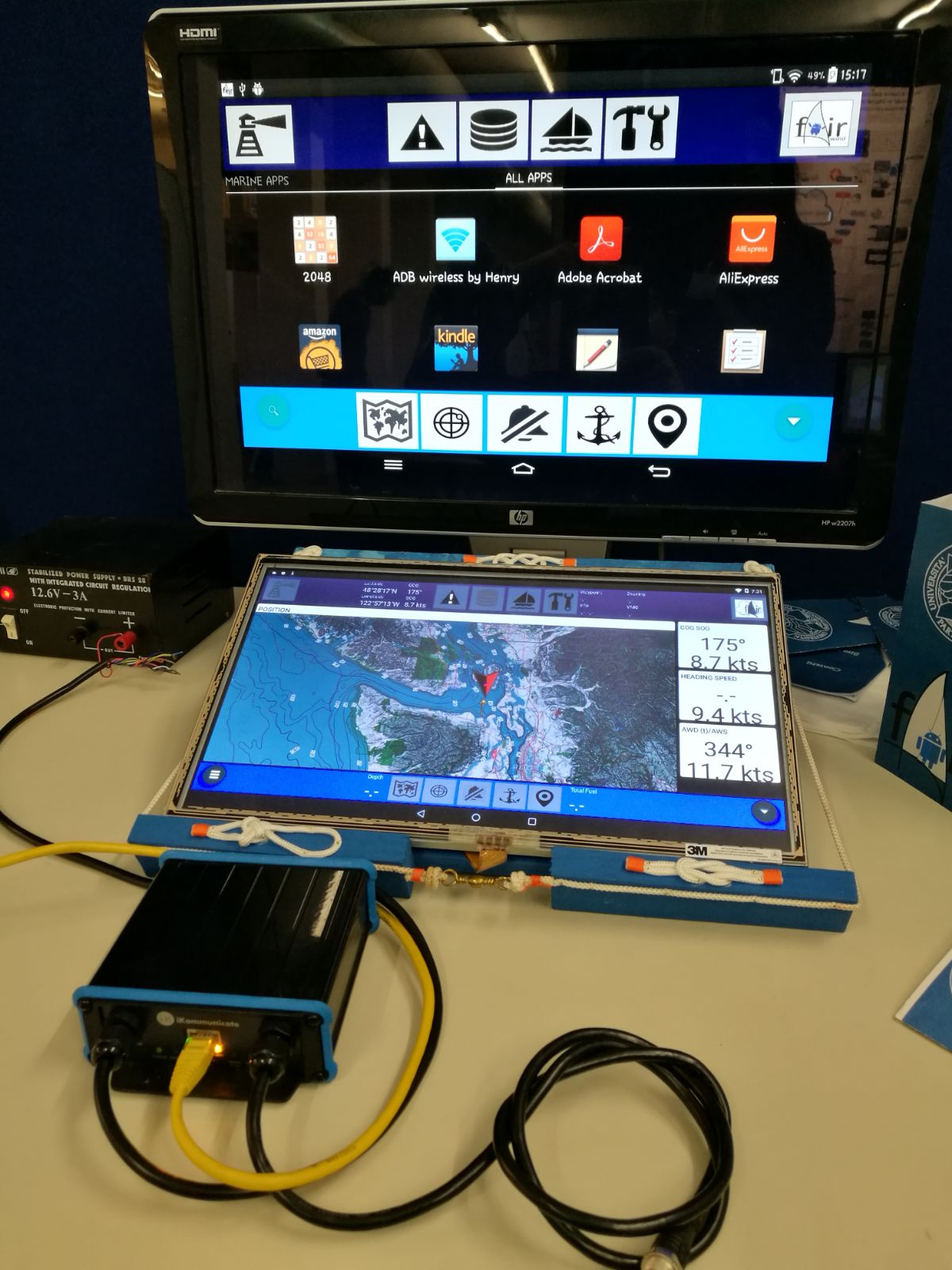
FairWind is an integrated multifunctional navigation software based on open technologies leveraging on an infrastructure built on mobile and web technologies. It is also defined as “Android-based Smart, Cloud-Enabled Navigation System for small Yachts with Boat Apps for never-ending custom improvements”. FairWind is an academic research-prototype project with the final aim to collect coastal marine data to be used for better understand and protect local ecosystems.
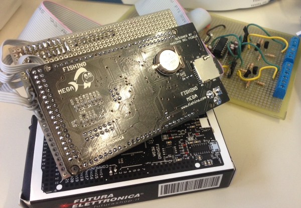
FairWind collects board data from NMEA0183*, NMEA2000* and SeaTalk* data sources with open source/open hardware interfaces based on Futura Elettronica Fishino Mega (http://fishino.com) or using high quality certified marine electronics as the Digital Yachts iKommunicate (http://ikommunicate.com ). The collected data are stored and produced to other apps using the SignalK (http://signalk.org) open marine data format. With FairWind you can use position data from the on-board GPS with nautical chart apps on an Android tablet. A demo application based on UDOO Neo and Vufine+ (http://vufine.com) shows navigation data in an augmented reality environment. The FairWind application is available on the Google Play Store. In order to gather data from on-board electronics, a free license is needed.
The team members currently are: Raffaele Montella, Team Leader; Diana Di Luccio, Data management; Carmine Ferraro, Developer; Federica Izzo, Social Media Marketing & Communication. For further information on FairWind and its applications: http://fairwind.uniparthenope.it/en/.
* Names registered by the copyright holders.